
Juan Portela, a member of the TERRA Research Group, provides us some insight on this topic in this new #EELISANarator episode, in which he shares his experience as one of the organizers and participants of the collaborative Mapathon that took place last month at ETSITGC, which is part of Universidad Politécnica de Madrid.
A mapathon consists in a collective work session that has the aim of creating a digital map of a specific area with the help of a remote web platform that can be accessed from different locations. This action can be made to give an answer to diverse needs.
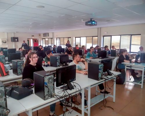
On March 9, 2023, a group of volunteers gathered at the Engineering School of Surveying, Geodesy, and Cartography of the Universidad Politécnica de Madrid under the leadership of the TERRA Research Group. Our task was to help map areas in Syria and Türkiye that had been affected by the series of damaging earthquakes that started on February 6, 2023.
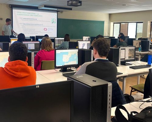
This event was held within the framework of a Humanitarian OpenStreetMap Team (HOT-OSM) project. HOT-OSM provides a framework for collaborative mapping, offering tools, satellite images, tutorials, feedback… And with no need of downloading any software or data.
We focused on digitalising buildings and roads throughout the Idlib district, Syria, as it had the lowest percentage of completely mapped areas within the activated HOT project “Turkey and Syria Earthquake Response February 2023”. After going through the map editing tutorials, we got down to business. In the end, we were more than 30 people from different backgrounds working together (Bachelor and Msc students, Ph.D. candidates, professors, and workers…), both in-person and online. The nine attendees who managed to accurately map the highest number of features received an award sponsored by the EELISA network of universities.
Many participants felt motivated by the activity and wanted to keep helping with such events. As a result, a volunteer team has been established to provide support through mapping and other necessary tasks during emergency situations.
But anyone reading these lines can contribute. There are still some areas that need to be mapped in Türkiye and Syria, as well as in other regions (e.g. areas of Malawi that were hit by Cyclone Freddy). As a recommendation, we advise carefully reading all the instructions and the feedback provided by expert validators. Visit https://www.hotosm.org/, go through the tutorials, and start mapping!
Juan Portela
TERRA Research Group
Universidad Politécnica de Madrid
More about Juan
He is a Predoctoral Researcher and Ph.D. candidate in Geomatics Engineering at the Universidad Politécnica de Madrid, as a member of the TERRA Research Group. His research is focused on the study of earthquakes using geodetic data (GNSS, InSAR) and modeling.